Love Livin' in Tumut NSW 2720
Prefer Homeowner Blog in Google Search
Love Livin' in Tumut NSW 2720
A river town with a mountain-country rhythm
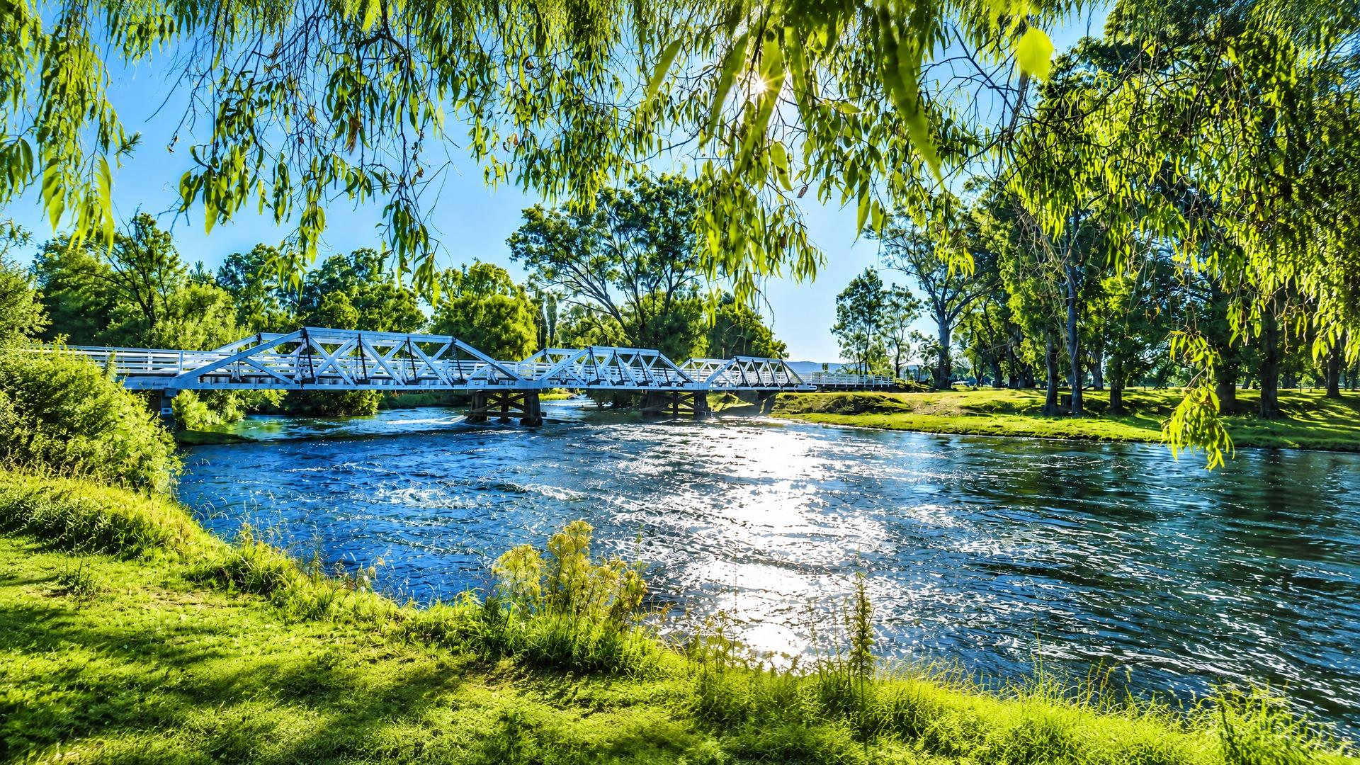
Tumut sits on the banks of the Tumut River in the western foothills of the NSW Snowy Mountains. It is a small regional town within the wider Snowy Valleys Council area, bordered by Kosciuszko National Park and the Murray River. 1 2 The town’s geography shapes its everyday rhythm: the centre is close enough to the river for a walk after work, while forests, reservoirs and mountain roads make a longer outdoor outing feel like a normal weekend rather than a special expedition.
That setting comes with practical distance. NSW Health describes Tumut as about 1.5 hours from Wagga Wagga, three hours from Canberra and 5.5 hours from Sydney; Visit NSW gives somewhat shorter estimates, so travel times will vary with route, traffic and conditions. 1 3 Wagga Wagga is the nearest airport identified by NSW Health, with daily QantasLink and Rex flights to Sydney and Melbourne. 1 A car is likely to be the most flexible option for work, shopping and recreation beyond the centre.
Water, forest and a strong sense of place
The Tumut River Walk leads towards the bird-rich Tumut Wetlands, where river red gums, lagoons and reeds give the town a gentle, low-key outdoor asset. Visit NSW notes that autumn turns the riverside foliage from green to gold, and that the walk passes the Tumut Community Labyrinth for Peace at Pioneer Park. 3 These are places for short, repeatable walks rather than bucket-list sightseeing: the kind of landscape that can become part of a weekday routine.
For bigger days out, Tumut is a launch point into the northern part of Kosciuszko National Park. NSW National Parks and Wildlife Service identifies Blowering Reservoir as a base for boating, sailing, waterskiing, fishing, canoeing and kayaking, with campgrounds and picnic areas around its shores. 2 The surrounding foothills add forest tracks, waterfalls and lookouts, including Buddong Falls, Blowering Cliffs and Landers Falls. The Snowy Mountains Highway links the area towards Talbingo, Adaminaby and Cooma, although NPWS cautions that roads and trails can close because of weather or park-management conditions. 2
Tumut’s identity is not only scenic. Its visitor centre operates from the historic Old Butter Factory on Adelong Road, and the town’s calendar includes the annual Falling Leaf Festival, held in April, as well as the Tumut Rodeo. 3 The wider Snowy Valleys Sculpture Trail brings public art to local towns, including Tumut. 3 These features combine working-town traditions with arts, food and outdoor tourism.
Services that anchor local life
For a town of its scale, Tumut has a meaningful service base. Tumut Health Service at 105–107 Simpson Street provides 24-hour accident and emergency care, hospital care, medical and day surgery, maternity, palliative and paediatric beds. NSW Government also lists community nursing, allied health, mental-health services and telehealth. 1 Highly specialised care may still require referral or travel, but the local health presence is substantial.
Council’s community-services framework includes accessible community transport for eligible people with disability and their carers, veterans, frail older residents and Commonwealth Home Support Programme clients across the Snowy Valleys. 4 Council also provides mapping resources for the area, including council maps, NSW Spatial Information Exchange (SIX Maps), the NSW Spatial Collaboration Portal and the Rural Fire Service bush-fire-prone-land tool. 5 Libraries, sporting organisations, volunteer groups and local businesses are part of the social infrastructure, although the availability and opening hours of individual services should be checked directly before relying on them.
Employment is tied to the regional economy rather than a single suburban office district. Snowy Valleys Council identifies agriculture and softwood timber as foundational industries, with major processing mills centred in Tumut and Tumbarumba. Retail, hydro-electricity generation, horticulture and tourism are also important. 6 Shift work, seasonal activity and industrial traffic may matter when choosing a street.
Schools, roads and connectivity
Tumut Public School is at 175–181 Wynyard Street. Its official travel information names Goode’s Coaches as the school-bus provider servicing the Snowy Valleys and Cootamundra-Gundagai shires. It also explains that free school-travel eligibility depends on year level and distance, with Kindergarten to Year 2 travel free regardless of distance and different rules for Years 3–6. 7 Tumut High School, at Bogong Place, provides comprehensive education from Year 7 to Year 12 and describes links with local families, organisations and community groups. 8 NSW Health also lists primary, high, special and Catholic schooling options in town, with Catholic schooling available through Year 10. 1
For public-transport planning across NSW, Transport for NSW provides a Trip Planner, route and timetable information, alerts and regional-travel booking tools. 9 In practice, Tumut’s school-bus network and regional coach options should be checked for the exact address and timetable rather than assumed from the town’s postcode. The road network remains central: the Snowy Mountains Highway is the principal scenic route into the national-park country, and Wagga Wagga, Canberra and Sydney are substantial drives.
Homes, streets and the checks that matter
Tumut’s housing character is best understood as a regional town rather than a uniform master-planned estate. Near the established centre, buyers may encounter older detached homes, mature gardens and easy access to civic, school and riverside destinations. On the edges, the setting can become more open and semi-rural, with larger blocks or different servicing arrangements. Those are broad patterns, not a substitute for inspecting each property; the exact mix of homes, lot sizes and redevelopment potential varies by street.
The landscape makes due diligence particularly important. Before making an offer, confirm the zoning and permitted uses through the Tumut Local Environmental Plan, investigate whether the site is flood-affected or exposed to overland flow, and use Council’s mapping tools and SIX Maps to check boundaries, easements and surrounding land. 5 Check bush-fire-prone-land mapping as well, especially where a home backs onto forest or open grassland. Ask about water, sewer, stormwater, road access and internet performance at the actual dwelling. A building and pest inspection should consider cold winters, drainage, retaining walls, tanks, sheds and any unapproved alterations. These checks are more useful than assuming that a quiet outlook guarantees low maintenance.
Who might enjoy Tumut?
Tumut may suit households wanting a slower, community-scale daily life without giving up a hospital, schools, local events and an active natural setting. It is particularly appealing to people who value river walks, fishing, paddling, cycling, bushwalking and access to Kosciuszko country. Families can find a local school pathway, while older residents may value nearby health and community-transport services, subject to eligibility and service capacity. 1 4
It may be less suitable for someone who needs frequent metropolitan commuting, extensive late-night public transport or immediate access to highly specialised services. The best fit is a buyer who is comfortable with regional travel, changing mountain weather and a town where the river, forest and working landscape are part of the address—not just the view.
References
More from Love Livin' series

Love Livin' in Bronte NSW 2024: Your Complete Suburb Guide
Bronte NSW 2024 offers exclusive beachside living with a family-friendly atmosphere, stunning ocean pool, and strong community spirit.

Love Livin' in Potts Point NSW 2011: Your Complete Suburb Guide
Potts Point NSW 2011 combines inner-city sophistication with bohemian charm, offering excellent dining and vibrant nightlife.

Love Livin' in Darlinghurst NSW 2010: Your Complete Suburb Guide
Darlinghurst NSW 2010 offers cultural and arts district with excellent amenity and lifestyle options.