Love Livin' in Pemberton WA 6260
Prefer Homeowner Blog in Google Search
Love Livin' in Pemberton WA 6260
Pemberton is a small South West town surrounded by the tall karri forests of Western Australia. It combines a compact country settlement with direct access to national parks, rivers and long-distance walking trails. The 2021 Census recorded 861 usual residents and 492 private dwellings in the Pemberton suburb and locality area. 1 For anyone weighing a move, the appeal is clear: nature is close, but everyday life still depends on planning around regional distances, weather and a relatively small service base.
Setting and character
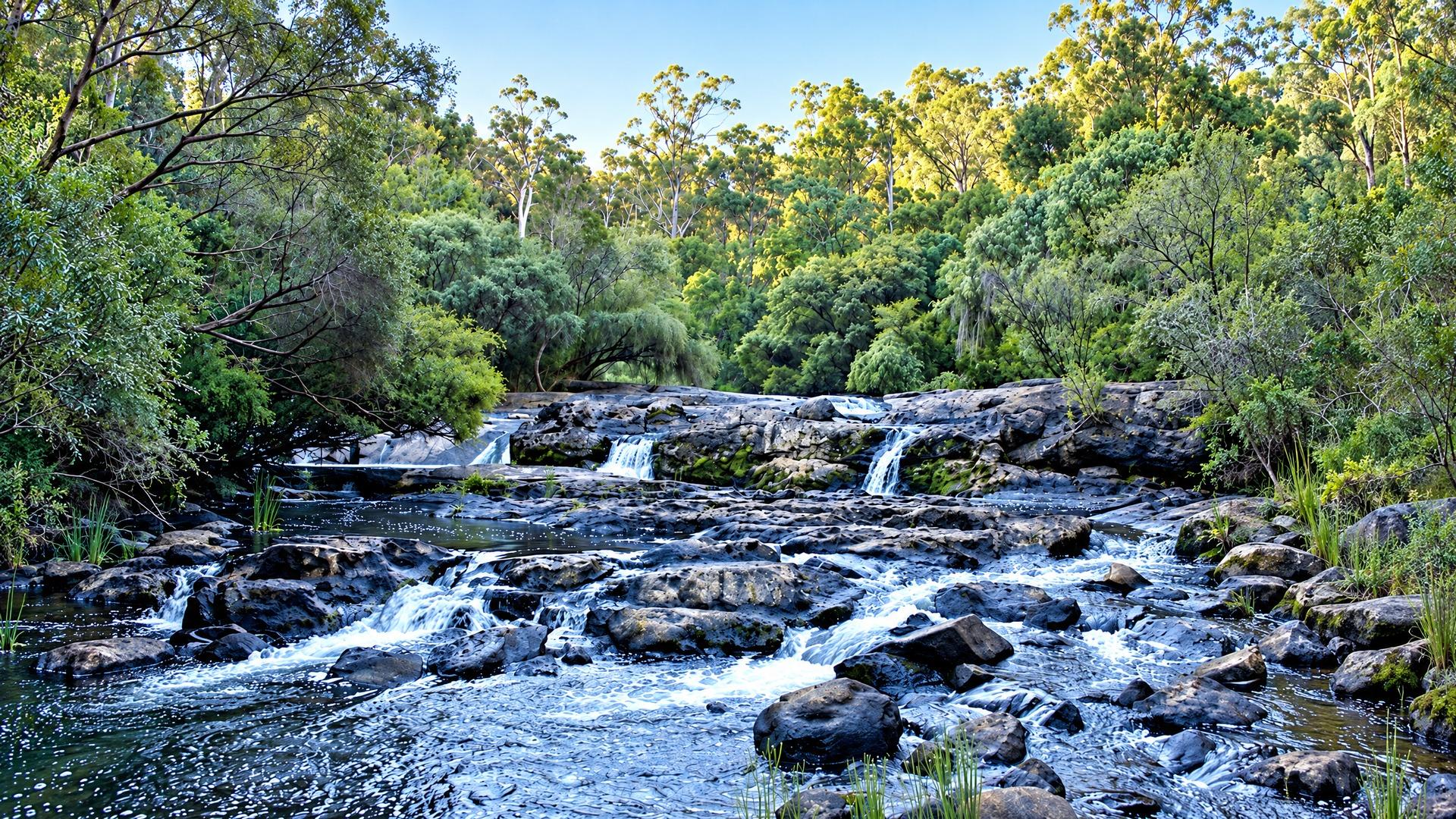
Pemberton sits in the Southern Forests, within the Shire of Manjimup. Karri trees are the defining landscape feature. Parks and Wildlife describes karris as trees that grow only in south-western Australia and can reach around 95 metres. 2 Around town, the forest is interspersed with pasture, streams, vineyards and productive rural land. The official Pemberton destination guide places the town about three hours and 45 minutes by road from Perth and identifies it as a base for exploring the wider South West. 3
The scale is genuinely local. Census data shows that 326 private dwellings were occupied on Census night, while 122 were unoccupied; 96.3 per cent of occupied private dwellings were separate houses. 1 Those figures describe the locality at the 2021 Census, not a current housing count, but they are useful context: this is a low-density country community rather than an apartment-oriented centre. The same profile records a median age of 48 and an average of 2.2 people per household. 1
Daily life and essential services
Pemberton’s town centre supports the practical rhythm of a regional community, with shopping, hospitality, visitor services and local organisations clustered close to residential streets. Broader council responsibilities sit with the Shire of Manjimup, whose online services cover rates, waste, facilities, building, planning and development. 4 Residents should expect some larger shopping, professional and government errands to involve Manjimup or another regional centre rather than being handled entirely in town.
Health care is a notable local provision. WA Country Health Service lists Pemberton Hospital Multipurpose Service with a 24/7 emergency department, pathology, physiotherapy, podiatry, occupational therapy, speech pathology, mental-health services, telehealth and residential aged care, among other services. 5 That is reassuring for routine and urgent local care, but it does not mean every specialist service is available locally. WACHS also operates the Patient Assisted Travel Scheme for eligible country residents who need to reach a specialist service not available in their home area. 6
The practical question for a household is less “is there a service?” than “how often will I need to travel for the service I use?” Families, older residents and people managing ongoing care should check appointment pathways, visiting practitioners and referral arrangements before committing. Internet and mobile performance can also vary beyond the built-up area, so test the exact address rather than assuming town-centre coverage.
Recreation and attractions
Outdoor access is part of ordinary Pemberton life, not just a visitor itinerary. Gloucester National Park is about three kilometres south of town on sealed roads and has walking trails, mountain biking and no entry fee. 2 Its trails range from the 800-metre Karri Views path to the 10-kilometre Gloucester Route. The park’s famous Gloucester Tree is currently listed as closed while viewing platforms are repaired, so check the current park alert before planning a climb. 2
Warren National Park adds a larger forest-and-river landscape. Parks and Wildlife describes its 3,000 hectares as suitable for bushwalking, camping and relaxing, with canoeing, kayaking, fishing and swimming among the listed activities. 7 The Dave Evans Bicentennial Tree has a 20-metre viewing platform, while the Warren River Loop Walk is a 10.5-kilometre moderately difficult trail. The park charges standard entry fees and does not allow dogs. 7
The broader Pemberton parks region includes Beedelup, Big Brook and other forest destinations. The Bibbulmun Track passes the town, and the regional parks guide identifies canoeing, fishing, swimming, bushwalking and mountain biking as popular activities. 8 Yeagarup Dunes, wineries, cellar doors and the Pemberton Tramway extend the choice beyond bushwalking, although many attractions require a car and some roads are gravel or seasonally affected.
Weather changes the experience. Parks and Wildlife warns that November to April can be extremely hot and coincides with bushfire season; closures, cancelled events and fire restrictions can occur without notice. Winter brings most of the region’s rainfall and cold nights. 8 Most parks do not provide drinking water, so visitors are advised to carry enough for their own use. 8
Travel and access
A car is the simplest way to connect a Pemberton home with work, school, shopping and outlying recreation sites. Perth is a substantial drive, while Manjimup is the nearer regional service centre. Main Roads WA’s Travel Map provides current information on closures, roadworks and incidents, which matters when weather or bushfire affects routes. 9
Public transport is available but limited. Transwa’s SW2 coach runs from East Perth to Pemberton via Bunbury and Donnybrook, with scheduled services listed for Monday, Wednesday, Thursday and Friday patterns. The Pemberton stop is at the Visitor Centre, and the timetable notes that amendments may apply on public holidays and school holidays. 10 The service is useful for planned regional travel, but its timetable is not a substitute for an urban bus network. Check the live timetable and book ahead where required.
Practical property and buying considerations
Start with the exact property, not just the postcode. The Shire’s planning and development service covers development approval, subdivision, holiday accommodation, home-based business, vegetation clearing and building in a bushfire-prone area. 4 Before making an offer, confirm zoning, permissible use, approvals for existing structures, access arrangements and whether any future project would need council consent.
Bushfire planning deserves particular attention in a forested locality. Ask for the property’s bushfire-prone status, access and evacuation arrangements, vegetation constraints and any required construction standard. A building inspection should look beyond cosmetic condition to drainage, damp, roofing, heating, septic or wastewater systems, water supply and sheds. Rural and edge-of-town blocks may also involve unsealed roads, longer driveways, tanks, pumps or private infrastructure; verify who maintains each component and what ongoing costs apply.
Finally, check boundaries, easements, covenants and services through the relevant searches and contract process. If a property is marketed for short-stay accommodation or a home business, confirm that use with the Shire rather than relying on advertising language. These checks are practical safeguards, not predictions about value.
Pemberton suits people who want a small community framed by exceptional forest and are comfortable making regional travel part of the week. Its rewards are tangible: a walk can begin near town, a river or national park can shape a free afternoon, and essential health support is present locally. The trade-off is equally concrete—limited public transport, seasonal park conditions and the need to investigate each property’s bushfire, access and service details carefully.
References
More from Love Livin' series

Love Livin' in Bronte NSW 2024: Your Complete Suburb Guide
Bronte NSW 2024 offers exclusive beachside living with a family-friendly atmosphere, stunning ocean pool, and strong community spirit.

Love Livin' in Potts Point NSW 2011: Your Complete Suburb Guide
Potts Point NSW 2011 combines inner-city sophistication with bohemian charm, offering excellent dining and vibrant nightlife.

Love Livin' in Darlinghurst NSW 2010: Your Complete Suburb Guide
Darlinghurst NSW 2010 offers cultural and arts district with excellent amenity and lifestyle options.